Pages

Monday 31 October 2016

Walk 31st October 2016 West Hanger CP - NDW - Fox Way - East Clandon - Fullers farm


Start point:- TQ070493
Distance:- 10.2 km; 6.34 miles
Time taken:- 2 hours 6 minutes
Route:-
West Hanger CP - NDW - New Scotland farm - Old Scotland Farm - Fox Way - Clandon Regis Golf club - East Clandon - Blakes Lane - Fullers Farm - Woodcote Lodge - Combe Lane - CP

This walk is a sighting walk for one I shall be leading for Mole Valley Ramblers later in November.

The walk starts at West Hanger car park and follows the North Downs Way. West Hanger is a nature reserve  http://www.surreywildlifetrust.org/reserves/shere-woodlands and the area has interest with Neolithic flint quarries and from WW2 - when the area had Canadian troops billeted in the locality. The walk passes the Tillingbourne brewery at Old Scotland farm http://www.tillybeer.co.uk/ , and follows the Fox Way http://thefoxway.com/index.php to Clandon Regis Golf club.

The Surrey village of East Clandon, 4 miles east of Guildford is made up of 110 homes clustered around the communal buildings of the 12th century Church of St Thomas of Canterbury, The Queen's Head pub and the village hall. The tiny 2.25-square-mile (586 hectare) parish landscape at the foot of the North Downs includes a traditional country estate, arable and livestock farmlands, woodlands, a golf course and Hatchlands Park, a National Trust property. http://www.eastclandon.org.uk/

East Clandon village dates back to the Doomsday period.


The walk re-crosses the busy A road to Guildford into Blake's Lane. And High Clandon vineyard can be found on a access road leading off the lane. http://www.highclandon.co.uk/

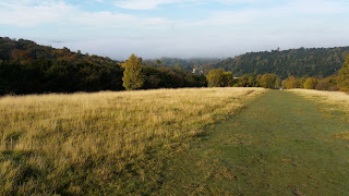
The walk passes Fullers farm https://youtu.be/9hKQyDTi3hs. The path up to the farm has good views towards London and the surrounding countryside forwards High Clandon vineyard.

This walk can also be found on the Fancy Free walks website.


I have parked in East Clandon when walking the route as the pub will then be located at the end of the walk. Parking within East Clandon with a large walking group would not be feasible

Friday 28 October 2016

Walk 27th October 2016 Boxhill - Juniper Top - High Ashurst - Mickleham - Norbury Park - Westhumble


Start point:- TQ171520
Distance:- 15.6 km; 9.7 miles
Time taken:- 3 hours 38 minutes
Route:-
Ryka's CP - Boxhill (Salomons Memorial) - Flint Hill - Juniper Top - High Ashurst - Cockshot Cottages - White Hill - The Gallops - Churchill Yew - Mickleham Downs - Mickleham Church - Norbury Park - Lodge Farm - Nicols Field - Westhumble - CP

Juniper Top looking towards Juniper Hall

High Ashurst looking towards Juniper Hall

Near to Lodge farm looking towards Norbury Park House

Juniper Hall is an 18th century house now leased from the National trust and where science and geographical studies can be conducted.


Wednesday 26 October 2016

Walk 26th October 2016 Boxhill - Juniper Top - Mickleham Downs - Westhumble


Start point:- TQ171520
Distance:- 8.78 km; 5.46 miles
Time taken:- 2 hours 54 minutes
Route:-
Ryka's CP - Boxhill hillside - Viewpoint - Zig Zag Road - Flint Hill - Juniper Top - Mickleham Downs - Mickleham church - Cowslip Farm - Westhumble - CP

This walk was led by a member of Mole Valley Ramblers with 34 in the group. And the time taken to cover the route is a reflection of the numbers walking. Naismith's rule roughly as a best estimate works to 4km per hour or about 2.5 miles per hour https://en.wikipedia.org/wiki/Naismith%27s_rule

There are 182 steps leading up from White Hill car park. And a different walk which can be found in Fancy Free Walks website http://fancyfreewalks.org/Surrey/WhiteHillHeadley.pdf

Tuesday 25 October 2016

Walk 24th October 2016 Boxhill - Juniper Top - High Ashurst - Mickleham - Westhumble


Start point:- TQ171520
Distance:- 14.2 km; 8.83 miles
Time taken:- 3 hours 11 minutes
Route:-
Ryka's CP - Boxhill hillside - Viewpoint - Flint Hill - Juniper Top - High Ashurst - Cockshot Cottages - White Hill - The Gallops - Churchill Yew - Mickleham Downs - Mickleham Church - Westhumble - Burford Bridge - CP


Sunday 23 October 2016

Walk 20th October 2016 Boxhill - Juniper Top - High Ashurst - Mickleham


Start point:- TQ171520
Distance:- 12.3km; 7.64 miles
Time taken:- 2 hours 50 minutes
Route:-
Ryka's CP - Boxhill hillside - Viewpoint - Flint Hill - Juniper Top - High Ashurst - Cockshot Cottages - White Hill - The Gallops - Churchill Yew - Mickleham Downs - Downs Road - Thames Downs Link - CP

Walk 19th October 2016 Ryka's car park - Westhumble - Ranmore Common - Denbies


Start point:- TQ171520
Distance :- 10.7 km; 6.65 miles
Time taken:- 3 hours 6 minutes
Route:-
Ryka's CP - Westhumble - Ashcombe Wood - Dorking Wood - Rectory - Ranmore Common (Denbies) viewpoint - Pilgrims Way - Mole Gap Trail - NDW - A24 - CP

This walk was led by a member of Mole Valley Ramblers with 39 in the group. The time taken to cover the distance is a reflection of the numbers walking

Tuesday 18 October 2016

Walk 17th October 2016 Boxhill - Juniper Top - Hish Ashurst - Mickleham - Westhumble


Start point:- TQ171520
Distance:- 14.5 km; 9.01 miles
Time taken:- 3 hours 17 minutes
Route:-
Ryka's CP - Boxhill hillside - Viewpoint - Flint Hill - Juniper Top - High Ashurst - Cockshot Cottages - White Hill - The Gallops - Churchill Yew - Mickleham Downs - Mickleham Church - Westhumble - Burford Bridge - CP

This walk has a slight variation at the start in that I take a path at the top leading more to the Salomans memorial viewpoint avoiding the café area at the top managed by the National Trust.

Also after walking up the path on the slopes of White Hill I looked for a small path at the top of the steps which lead up from Juniper Bottom. But without success so the walk distance would have been slightly shorter by about 400 metres.


A cloud scape from Boxhill. I felt I was going to get wet!!

Walk 14th October 2016 Boxhill - High Ashurst - Mickleham - Westhumble


Start point:- TQ171520
Distance:- 13.6 km; 8.45 miles
Time taken:- 3 hours 3 minutes
Route:-
Ryka's CP - Boxhill hillside - Viewpoint - Flint Hill - Juniper Top - High Ashurst - Cockshot Cottages - White Hill - The Gallops - Churchill Yew - Mickleham Downs - Mickleham Church - Fredley Manor - Westhumble - Burford Bridge - CP

I after leaving Ryka's car park took the path up the hillside rather than the more sunken but easier ascent to the top. The views using this path are much better as you can look towards Denbies vineyard and across in the opposite direction to the zig zag route taken by the minor road.

The route will pass the grave of Peter Labilliere, and eccentric living in Dorking who was buried head first in accordance with his wishes on the hillside. His grave had to be moved further from the edge however at some point in the past. http://www.thegranthams.co.uk/paul/graves/labilliere.html

The path moves on to the Boxhill viewpoint https://en.wikipedia.org/wiki/Box_Hill,_Surrey

Then follows a route walked before except passing Fredley Manor and on towards Westhumble.

https://en.wikipedia.org/wiki/Westhumble

Wednesday 12 October 2016

Walk 12th October 2016 Boxhill - High Ashurst - Mickleham - Norbury Park - Westhumble


Start point:- TQ171520
Distance:- 15.4 km; 9.57 miles
Time taken:- 3 hours 18 minutes
Route:-
Ryka's CP - Boxhill (fort) - Viewpoint - Flint Hill - Juniper Top - High Ashurst - Cockshot Cottages - White Hill - The Gallops - Churchill Yew - Mickleham Downs - Mickleham Church - Norbury Park - Beechy Wood - Nicols Field - Burford Bridge - CP

Walk 10th October 2016 Boxhill - High Ashurst - Mickleham


Start point:- TQ171520
Distance:- 12.9 km; 8.02 miles
Time taken:- 3 hours 34 minutes
Route:-
Ryka's CP - Boxhill (fort) - Viewpoint - Flint Hill - Juniper Top - High Ashurst - Cockshot Cottages - White Hill - The Gallops - Churchill Yew - Mickleham Downs - Mickleham Church - CP

Friday 7 October 2016

Walk 6th October 2016 Boxhill - Juniper Top - High Ashurst - White Hill - Churchill Yew - Mickleham


Start point:- TQ171520
Distance:- 12.5 km; 7.77 miles
Time taken:- 2 hours 45 minutes
Route taken:-
Ryka's CP - Boxhill (fort) - Flint Hill - Juniper Top - High Ashurst - Cockshot Cottages - White Hill - The Gallops - Churchill Yew - Mickleham Downs - Mickleham Church - CP

Walked up from the car park taking a path to the right of the zig-zag road up to Boxhill, and past the fort.

Box Hill Fort is believed to be one of the earliest examples of the use of reinforced concrete in construction and was built in the 1890's for the defence of London.
General Sir Edward Hamley, a leading military strategist, conducted a campaign for the adoption of measures to prevent invasion from continental Europe. Unlike most of the other leading soldiers of the day, Hamley was an enthusiastic supporter of the volunteer forces and considered that they could play an important part in the defence of the capital in the event of an invasion. He outlined a scheme for the establishment of a line of lightly fortified assembly points around London.
At Box Hill, 2.4 hectares (6 acres) were bought in 1891 for £2,221 and the fort, which cost £4,714 to build, was completed by 1900. In accordance with the tactical thinking of the time, the Box Hill fort was not designed for artillery. Rather, it consisted of concrete ramparts which protected nearby trenches from which the infantry would fight.
Never used for its intended purpose, it is now part of the National Trust Box Hill property and home to three species of bats that have taken up residence in the tunnels originally built for ammunition storage. As bats are a protected species in the UK the interior of the fort is not open to the public, however you can freely wander around the exterior which is accessible via a public footpath.

I should have walked to the Boxhill viewpoint, and instead crossed the car park picking up a path to eventually come down Juniper Top. There is a short walk available on the Fancy free walks website

http://fancyfreewalks.org/Surrey/JuniperBoxHill.pdf.

As an alternative the National trust have a self guided walk from Boxhill

https://www.nationaltrust.org.uk/box-hill/trails/box-hill-juniper-top-circular-walk

Then I followed the route from the 5th October 2016 and diverting to Mickleham church after walking the reopened footpath mentioned in the previous entry.

Walk 5th October 2016 Juniper Bottom - High Ashurst - Mickleham


Start point:- TQ171520
Distance:- 9.43 km; 5.86 miles
Time taken:- 3 hours 18 minutes
Route:-
Ryka's CP - Juniper Bottom - High Ashurst - Cockshot Cottages - White Hill - The Gallops - Churchill Yew - Downs Road - CP

This walk was led by a member of the Mole Valley ramblers. The time taken reflects the numbers walking on the day (33). And in addition one member of the group injured himself and had to be recovered.

The walk follows a newly designated footpath,

http://mycouncil.surreycc.gov.uk/documents/s26016/RoW%20Mickleham%20CP548%20Com%20report.pdf

which we joined from the Gallops at the top of White hill. Path section from TQ185540 to TQ181539. On this reopened footpath which follows the boundary fence for Cherkley Court you can see Heathrow airport and West London. A yew tree planted by Winston Churchill when he visited Lord Beaverbrook who originally owned Cherkley Court, can be found on this reopened footpath

Tuesday 4 October 2016

Walk 3rd October 2016 Norbury Park - Headley Heath - Mickleham - Norbury Park


Start point:- TQ163551
Distance:- 17.5 km; 10.88 miles
Time taken:- 3 hours 42 minutes
Route:-
Young St (Lower) CP - Mole Gap Trail - Downside Manor - The Garden House - Nower Wood - Langley Lane (Track) - Headley - Goodman's Furze - High Ashurst - Cockshot Cottages - White Hill - Mickleham Church - Norbury House - Viewpoint - Denshire Hill - Fetcham Downs - Updown Wood - CP

This walk will reward with different views of countryside combined with autumn sun makes a very enjoyable walk.

Leaving the car park and walking past Cherkley Court towards Nower wood - golf course views. Crossing the road into Langley lane and turning right onto a footpath you'll get views across the valley which would be hidden if you stuck to the lane. The drawback - 6 stiles but the views are worth it. Onto Headley heath again views across the heathland. High Ashurst - dropping down to Cockshot cottages views looking towards White hill. And crossing the road take the small footpath off to the left which will take you diagonally up White Hill. The path is not well used but again excellent views, you will reach a viewpoint looking towards Denbies vineyard.

On to Mickleham church and across the busy A road into Norbury Park, walking up the access road to the house you'll see Leatherhead. Walking past the sawmill on to the viewpoint looking out towards Juniper Top and Mickleham bends. Leaving the viewpoint taking the path into the woods you come out looking across to Fetcham which again you'll get the view from Fetcham Downs. Finally down the hillside to the car park and again a good view of Leatherhead and Mickleham bends.