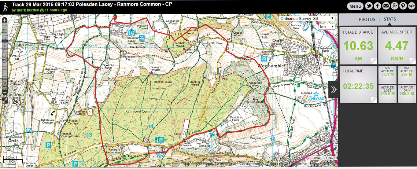
Pages

Thursday 31 March 2016

Walk 30th March 2016 Epsom Racecourse - Headley church


Start:- TQ222578
Distance 11.22km; 6.97 miles
Time taken:- 3 hours 24 minutes
Route:-
Epsom Downs "the Hill" CP - Nohome Farm - Twistwood - Costal Wood - Headley church - Addlestead Wood - Thirty Acre Barn - Langley Vale farm - Walton Downs - CP

This walk was led by a member of Mole Valley Ramblers.

Headley appears in Domesday Book of 1086 as the manor of Hallega. It was held by Radulfus (Ralph) de Felgeres. Its Domesday assets were: 2 hides; 6 ploughs, woodland worth 15 hogs. It rendered £5 per year to its overlords. The survey records that the manor was held before the conquest by Countess Goda (the mother of King Harold) and it had been granted to her by King Edward the Confessor. Halle(g)a means a clearing in the heather, which is appropriate considering the village's position on a large patch of acidic topsoil of the generally alkaline North Downs.

The church, dedicated to St Mary and designed by Anthony Salvin, was built in 1855, with an added tower of 1859 by G. E. Street. It is built from relatively local flint rubble and is listed Grade II.

Headley's land lay in the Saxons' Copthorne Hundred. As Saxon records are scant and the church and population were smaller, no church in Headley was known during this period; the first records of a church are after the Norman Conquest. Next to the present 19th-century church is a grotto, constructed using materials from the earlier 15th-century church and placed over the grave of the Revd Ferdinand Faithful.

Information on Epsom racecourse can be found at the following web page 


Tuesday 29 March 2016

Walk 29th March 2016 - Polesden Lacey - Denbies - NDW - Yewtree farm


Start:- TQ133523
Distance 10.7km; 6.62 miles
Time taken 2 hours 22 minutes
Route:-
Polesden Lacey CP - ChapelHill Wood - Beech - NDW - Denbies -Ranmore Common Church - Viewpoint - Hillside path - NDW - Yewtree Farm - Big High Grove - CP

The day started off bright and sunny and deteriorated by noon only to brighten up after ensuring I got wet! After Storm Katie which went through early Monday morning several trees have been brought down with a small tree fallen across the path near the area known as Ranmore roundabout close to the scout camp site.

Reports can be made at the following website:-

https://rightsofway.surreycc.gov.uk/ReportFault.aspx

Thursday 24 March 2016

Walk 24th March 2016 - Polesden Lacey - Yewtree farm - NDW - hillside - Denbies - Beech - Chapel Wood


Start point:- TQ133523
Time taken 2 hours 21 minutes
Distance 10.93 km; 6.79 miles
Route:-
Polesden Lacey CP - Big High Grove - Yewtree farm - NDW - Hillside path - Viewpoint - Ranmore Common Church - Denbies - NDW - Beech - Chapel Wood - Chapelhill Wood - CP

Today's walk is mostly yesterday's walk but anti clockwise. The path from TQ126519 to TQ127518 can be muddy. There is a path just you leave the wood via the gate that goes to the right if you follow that you can avoid a muddy section along the grid references shown above.

The views again are good walking the reverse dircetion compared to the 23rd March 2016. And I feel that the views are better than today's route

Walk 23rd March 2016 - Polesden Lacey - Denbies - NDW - Yewtree farm


Start point:- TQ133523
Distance:- 10.8 km; 6.71 miles
Time taken:- 3 hours 8 minutes
Route:-
Polesden Lacey CP - ChapelHill Wood - Beech - NDW - Denbies -Ranmore Common Church - Viewpoint - Hillside path - NDW - Yewtree Farm - Big High Grove - CP

This walk I lead for Mole Valley Ramblers with a group total of 36. This number of walkers will significantly increase the time taken for the walk, as there are 5 stiles in addition to several "kissing gates" on route all of which will require negotiation by all walkers.

Additional notes refer to entry for Friday 18th March 2016.

Monday 21 March 2016

Walk 21st March 2016 Shere Millennium trail from Walking Bottom CP Peaslake via Hazel Hall


Start point:- TQ083446
Distance:- 18.3 km; 11.37 miles
Time taken:- 3 hours 49 minutes
Route:-
Walking Bottom CP - Hazel Hall - Jesses Lane - Drydown Farm - Ponds Farm - Ponds Lane - Shere Heath - Dark Lane - Cycle Route 22 - Towerhill Lane - Hazelhatch - Broadfield Road - Hoe Farm - Tenningshook Wood - YH - Hombury St Mary church - Greensand Way - Somerset Hill - Holmbury Hill - Hurt Wood - Riding Copse - Peaslake church - CP

The walk differs as it takes the footpath towards Hazel Hall, where the actual trail passes rather than walk towards Lockhurst Hatch farm as the previous Monday 14th March 2016. The walk up towards Shere includes some interesting views.

There is an opportunity to do a shorter walk starting at Shere CP walking south to Broadfield Road and when reaching the road to Peaslake taking the first footpath on the right at the start of some cottages (Pursers farm will be on your left) as at that point you would be less than 500 metres from the return path to Shere (Jesses lane). Jesses lane is a single track road but whenever I have driven and walked down it it is a very quiet road, the section to be walked on the road is short about 200 metres but again take care. Cotterells farm to Drydown Farm the road section is again about 200 metres and it is a busier road but with some pavements to walk.

The parish of Shere, which also includes Gomshall and Peaslake - were associated with the industries of weaving and tanning. Shown on a map of 1753 it says that Shere and Gomshall are famous for the weaving of fustain. (a coarse cloth, thick twilled) http://www.thefreedictionary.com/fustian

Shere church - 1329 Christine Carpenter the Anchoress of Shere was imprisoned for several years in the 14th Century, according to a 12th century chronicler Father Michael Duval. St James church Shere built in 1190 built in the early English transitional style. The nave pews were originally numbered and people paid the church to rent them. http://www.sheredelight.com/history.html

More detail on Shere can be found here http://www.british-history.ac.uk/vch/surrey/vol3/pp111-121

Friday 18 March 2016

Walk 18th March 2016 Polesden Lacey - Westhumble - Denbies - Ranmore Common - Yew Tree farm


Start point :- TQ133523
Distance 10.52 km; 6.54 miles
Time taken:- 2 hours 16 minutes
Route:-
Polesden Lacey CP - ChapelHill Wood - Beech - NDW - Denbies -Ranmore Common Church - Viewpoint - Hillside path - NDW - Yewtree Farm - Big High Grove - CP

This is a walk I will be leading next Wednesday for Mole Valley Ramblers. This walk has many views and I hope for good sunny weather to show it off at its best. Views include - London, Crabtree cottages, Westhumble, Boxhill, Denbies vineyard, Dorking, Leith Hill and Polesden Lacey house.

Polesden Lacey - an Edwardian house now owned by the National Trust. The house was remodeled in 1906 by Margaret Greville. There have been houses in this location since 1336, Antony Rous bought the estate in 1630 and rebuilt the medieval house. Richard Sheridan bought the house in 1804. And later after Joseph Bonsor bought the house he commissioned an entirely new property which forms the core of the current building. https://en.wikipedia.org/wiki/Polesden_Lacey

Walking the footpath through the Beeches you get a view of Westhumble and surrounding valley https://en.wikipedia.org/wiki/Westhumble

Denbies vineyard - 265 acres on of the largest vineyards in England. The estate takes its name from the original owner John Denby  https://en.wikipedia.org/wiki/Denbies_Wine_Estate The original buildings were bought by Thomas Cubitt remaining in the Cubitt's family ownership till the second World War. Now owned by Adrian White.

St Barnabus church and old school on Ranmore Common, George Cubitt commissioned George Scott to design the church and school house completed in 1859. His design was "high victoriana" - a scaled down cathedral to serve the workers and families on the estate.  http://www.achurchnearyou.com/documents/2011-12-12_26638_1323723107.pdf

Wednesday 16 March 2016

Walk 16th March 2016 Headley Heath - High Ashurst - White Hill - Nower Wood - Langley Lane


Start Point:- TQ205539
Distance:- 8.95 km; 5.56 miles
Time taken 2 hours 48 minutes
Route:-
Headley Heath NT CP - High Ashurst - Cockshot Cottage -  White Hill - The Nower Wood - Langley Lane - Heath House - CP

This was a led walk by a member of Mole Valley Ramblers. Good views. In spring Headley Heath area has bluebells on the way to High Ashurst.

The Gallops were settled in the Bronze age with later 3 Roman farms present in the area. the Roman Road - Stane Street is nearby. 18th century saw the use of this area to be more for leisure activities associated with the nearby Cherkley court


Monday 14 March 2016

Walk 14th March 2016 Shere Millennium trail from Walking Bottom CP Peaslake


Start point:- TQ083446
Distance:- 18.43 km; 11.45 miles
Time taken 4 hours 4 minutes
Route:-
Walking Bottom CP - Hound House - Lockhurst Hatch Farm - Ponds Lane - Shere Heath - Dark Lane - Cycle Route 22 - Towerhill Lane - Hazelhatch - Broadfield Road - Hoe Farm - Tenningshook Wood - YH - Hombury St Mary church - Greensand Way - Somerset Hill - Holmbury Hill - Hurt Wood - Riding Copse - Peaslake church - CP

The Shere Millennium trail can be started from a number of different car parks, including Shere, Gomshall, Youth Hostel and Walking Bottom. I took a slightly longer route before joining the trail by starting at the CP walking North West to Lockhurst Hatch Farm and walking for a longer length on Ponds Lane. The trail crossed the railway line at Shere Heath via a pedestrian crossing, trains will sound their horn on approach. Ponds Lane may well have bluebells later in the year. There are some surprising views to be had. Road sections have pavements to walk on with exception of the roads around Hoe. Walking north from Holmbury Hill into Hurt Wood you will see the North Downs. 

Friday 11 March 2016

Walk 11th March 2016 Bookham Common


Start point:- TQ141556
Time taken 2 hours 8 minutes
Distance :- 9.98 km; 6.20 miles
Route:-
Kennel Lane - Great Bookham Common - Bookham Road - Isle of Wight - Hazel Way

Foggy day still with cold, needed something local and easy to get to mainly to keep on track for 1,000 mile challenge.

Paths meandering in Great Bookham Wood were very muddy in some cases. I had a chance to see changes in the stud farm on Bookham Road, plus get a glimpse of the M25 services.

I also looked at part of the Bookham Common NT family trail - muddy!

Thursday 10 March 2016

Walk 10th March 2016 Walking Bottom Peaslake - Holmbury St Mary - Holmbury Hill - Pitch Hill - Ewhurst Windmill - Wickham Copse - Peaslake


Start point:- TQ083446
Distance 12.9 km; 8.05 miles
Time taken 3 hours 6 mins
Route:-
Walking Bottom CP (Peaslake) - Hurtwood Chase - YH - Holmbury St Mary Church - Greensand Way - Somerset Hill - Holmbury Hill - Duke of Kent school - Pitch Hill - Ewhurst Windmill - Bentley Copse - Wickham's Copse - Peaslake - CP

My intention is to walk the Shere Millennium trail which can be picked up from the Walking Bottom car park, so the route mostly followed one from before with the diversion at Bentley Copse to Wickham's Copse and across the field back to Peaslake. There is a view from this field after Wickham's Copse looking north to the N Downs. The millennium trail can be picked up by turning left at the farm instead of right to Peaslake.

The path to drop down to Ewhurst from Holmbury Hill was identified as well

Wednesday 9 March 2016

Walk 9th March 2016 Meandering on Bookham Common


Start point:- TQ141556
Distance:- 8.3 km; 5.16; miles
Time taken:- 1 hour 37 minutes
Route:- 
Kennel Lane - Great Bookham Common - Little Bookham Common - Isle of Wight - Hazel Way

Always check were the start point of a walk is and give yourself time. So what did I do - oh I know MVR walking from Polesden Lacey or so I thought, result the car park at Polesden Lacey with a total absence of MVR ramblers! So after being hit with a cold Sunday/ Monday I decided to walk a local route somewhere near my house.

Discovering by looking at a local leaflet on Bookham Common which is National Trust owned - a family trail. So next time I can have a purpose. But I'm needing to keep minimum walking to at least 20 miles per week for the 1,000 mile Viewranger challenge.

Bookham Common under National Trust control has some very muddy, wet paths and some well drained ones. There are bird hides from which to watch ducks, possible grebes and deer. Kingfishers are a possibility as well. Bookham Common - ancient commons, mentioned in the Doomsday book with grassy plains, oaks trees and several ponds. http://www.nationaltrust.org.uk/bookham-commons

Further information on Bookham Commons, including scarce in Surrey - sedges, and wild roses can be found here:- https://en.wikipedia.org/wiki/Bookham_Commons.

It just goes to show how much there is to know about your own immediate locality. Butterflies such as the White Admiral can be found


Friday 4 March 2016

Walk 4th March 2016 Peaslake Walking Bottom CP - YH - Holmbury St Mary - Greensand way - Holmbury Hill - Pitch Hill - Ewhurst Windmill - CP


Start point :- TQ083446
Distance:- 12.2 km; 7.58 miles
Time taken:- 2 hours 54 minutes
Route: -
Walking Bottom CP (Peaslake) - Hurtwood Chase - YH - Holmbury St Mary Church - Greensand Way - Somerset Hill - Holmbury Hill - Duke of Kent school - Pitch Hill - Ewhurst Windmill - Peaslake House - CP

A slight variation on the walk from 3rd March 2016, dropping down to Holmbury St Mary's church then following Greensand way to Holmbury Hill. You will find football pitch and Cricket club along the route of the Greensand way. The cricket club was built in 1983 and is said to be one of the most picturesque club grounds. The pavilion was designed by William Narraway - a portrait artist. On the way to Holmbury hill you will also find views looking over to Leith Hill.

Near the youth hostel there appears to be evidence of old field boundaries and again to be found in the area near to Peaslake house.


Holmbury St Mary's church built in 1879 by George Edmund Street.https://en.wikipedia.org/wiki/Holmbury_St_Mary

On this walk there are two pubs - one at Peaslake - Hurtwood Inn http://www.hurtwoodinn.com/ and at Holmbury St Mary - The Royal Oak 


Thursday 3 March 2016

Walk 3rd March 2016 - Peaslake Walking Bottom CP - YH - Holmbury St Mary - Holmbury Hill - Pitch Hill - Ewhurst Windmill


Start point:- TQ083445
Time taken :- 2 hours 54 minutes
Distance:- 12.1 km; 7.52 miles
Route:-
Walking Bottom CP (Peaslake) - Hurtwood Chase - YH - Holmbury St Mary - Somerset Hill - Holmbury Hill - Duke of Kent school - Pitch Hill - Ewhurst Windmill - Peaslake House - CP

The walk is a variation on that done on 29th February 2016 to extend beyond the youth hostel towards Holmbury St Mary, taking a path that skirts the outside of the village along a hillside. This avoids any steep downhills and uphill later on when picking up the route to Holmbury Hill (857 ft, 261m)  from which you can get a glimpse of London if conditions permit. A view of London was just visible today.

Holmbury St Mary is located just south of Dorking, and is named after the hill and the church within the locality. https://en.wikipedia.org/wiki/Holmbury_St_Mary